This summer i have been using Google Earth for navigation by integrating BSB charts with Earth. The charts are overlaid to Earth and display all the chart information + the Earth information including terrain and ground images. With a connected GPS your position is plotted on Chart and Google Earth. The sytem still works without a network connection by using the cache. I am sure Google sooner or later will release their own marine navigation system My system is free as long as you have the BSB charts which I believe are free in the US via NOAA
Click on image for larger version
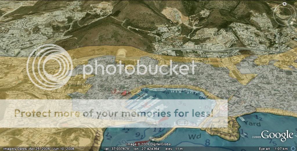
Chart set to transparent over Google Earth of Bodrum Harbour
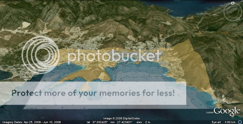
Wider view chart set to opaque
Same view chart set to transparent
Convert BSB chart by opening in your normal PC based navigation system and screen capture using Prt Sc button. Paste into paint or another paint or photo program program Save as a tiff file
or
Use a "BSB to tiff converion" program to convert the .kap file to .tiff fle
In Google Earth Add, image and browse to the converted .tiff file
Adjust image to line up the chart with the underlining Google image
when i sailed in the Canaries Last year,i found that google Earth was an excellent tool for Navigation,its not cast iron up to the last minute photos,but when you are going to enter an unknown harbour for the first time,it gives you a great view of it.
Any suggestions where I could find free-to-download BSB charts for the Gulf Region (e.g. Dubai UAE)?
I find Earth is great for tracking after the event - uploading from my GPSMAP 276C - but not really sensible in realtime (I prefer SeaPro 3000 due to its AIS support).
I have just invested in a KeyChain Bluetooth GPS receiver and can confirm that it is a phenomenally potent piece of kit which emphatically WILL work when inside your pocket with your keys. Unbelievable.
Also just bought a set of zippity-doo-dah Russian "Nikula" binos for not very much money; very very good (far better than my old Steiners) but does anyone know how to use a reticule rangefinder?
I have asked this question on GE forums for a year without an answer.
Here it is - related to the cache question above....
When using GE for navigation and when away from the internet it would be helpful to have cached the area details in the 2000 mb (2gig) data cache allowed by Google. If I cache an area (say Norfolk Va) and save the cache (how to do this is in Google Earth help) and I now have, say, 506mb of cache (let's say I call the saved file 506.db.) I keep the GE 506 mb cache under the original name and keep on going on GE building and adding to my cache. A week later after viewing new areas on GE, my cache is up to 789 mb. BUT, and a big BUT, is that the detail of Norfolk VA is overwritten and blurry. So I save the GE cache under a name, say 789.db. Then I reload the 506.db saved cache and Norfolk is there again.
I can not believe that this is how it is supposed to work. What a stupid way, if true. In my way of thinking, I should be able to have a perfectly customized 2000mb cache that is suited to my travels, so I can navigate offline. If GE overwrites cache, before reaching its maximum 2000mb, then what is the purpose of saving it? Unless, you are supposed to have a separate cache for each area of the world you travel in.