

Exumas
-
sailboatmike

- Admiral
- Posts: 1597
- Joined: Thu Mar 12, 2015 10:17 pm
- Sailboat: MacGregor 26X
- Location: Australia
Re: Exumas
Thats why they always put a weight in the bottom of the tarp, to keep it pointing in the right direction
Re: Exumas
sailboatmike wrote:For wave height normally shallower water is the worst, especially when swells come out of the deep and run into the shallower stuff, this makes the swells much higher, shorter distance between them and much steeper. (as per when waves stand up and break on a break).
Of course if you get wind against tide this makes for uncomfortable conditions, if possible sailing slightly further off the wind makes makes the motion better.
Excellent article on PBO website about this
Sounds like Westernport MIke
Re: Exumas
I've been in countless squalls in the icw or seen what it does to waters near shore ......if there is a 1 foot chop and it's a fairly nasty squall and turn it to a 3foot chop temporarily until the winds calm back down....... then water quickly returns to 1foot chop again....... if you're in the gulf in or the banks and 25 miles from land does a quickly running through squall that's typical in the afternoon change wave heights and duration significantly even if for a short period the way it does inshore waters? Will getting caught in a squall turn a 2-3 @9sec into 6-9foot right on top of each other making it extrmely dangerous ? (That is why i considered a sea anchor ...getting caught in a squall in the gulf or banks) During the summer months down south there is usually a fairly good storm every day in the afternoon ...crossing the gulf or banks I can't avoid being out in the open water 25 miles from land when the squalls usually rip through for 30 mins to an hour I just wonder how unsafe that makes the swells or ocean?
Re: Exumas
I just re read your accounts of crossing the banks and being caught in a squall sumner and it kinda seems the banks acts a lot like inshore waters so there goes my hope of that .....you went from fairly flat seas to 2 foot chop so I can't help but wonder if there was already a mild chop and you got hit would it be seriously dangerous conditions??? another option is I may have to get one of the radar xm weather units or something similar....... I use "My radar" app on my phone and it's been extremely helpful at avoiding those small but torrential pockets......simply seeing a large dark cloud forming on the horizon isn't enough (for me) to be able to predict exactly what direction or speed it's moving to make a path to avoid or skirt the outside which is what I always did on the icw and proved probably the most useful sailing app I've had......but with no cell signal I guess I will need to start seeing what else is available to duplicate that app but in an area with no cell signal
-
Sumner

- Admiral
- Posts: 2375
- Joined: Sun Jan 04, 2009 3:20 pm
- Sailboat: MacGregor 26S
- Location: SE Utah
- Contact:
Re: Exumas
Would depend on the direction of the current waves and the direction of the squall. They aren't always the same. What happened in that squall was more than a 2 foot chop. Remember that even if you are in 3 foot waves there will be the occasional sets of 5-6 foot waves. A true 5 foot wave in our boats is big. I think about the only time I'd want to put out a sea anchor would be if I was disabled. If I would of had one I wouldn't of put one out in that situation or in the situation on the run to George Town. In both cases motoring on was a better option in my opinion given the current conditions at the time.whgoffrn wrote:I just re read your accounts of crossing the banks and being caught in a squall sumner and it kinda seems the banks acts a lot like inshore waters so there goes my hope of that .....you went from fairly flat seas to 2 foot chop so I can't help but wonder if there was already a mild chop and you got hit would it be seriously dangerous conditions???...
You are right in that it is hard to tell exactly which direction the storm is going. Where I live in Utah the storms move WSW to ENE almost 90% of the time so it is very easy to see if you are going to get hit or not. You do have the advantage if the sea is still pretty flat of having more speed to get out of the way than I had but I wouldn't count on that in all situations. I'd be looking for people's trip accounts of cruising the Bahamas in the summer to see what might be more normal conditions for then.
For those that are interested here is an excerpt from the day of crossing the banks that was mentioned above ...
===================================================================================================================
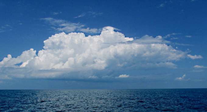
I started to see thunderheads forming like this one to the north that just seemed to sit there forever. Another built in the south and looked much more menacing but I thought it would slide by me and go off to the west.
Then it appeared that wasn't where it was going to go as after I took the picture above I could see for miles to the north, east and west, but not very far to the south. I got out my rain gear but just the top and not the bottoms, a mistake. Soon I could still see for miles to the north but only a few hundred yards to the south. Then the squall hit at about 4:30 pm and I mean hit. The wind was probably over 30 kts from the south and the seas immediately jumped so that I started to get sets of three footers very closely spaced. I couldn't continue East as they were coming in on the beam and really rolling the boat over. So I turned to SE and that helped a lot but the charts also showed a bank not to far to the south as I was coming up on Mackie Shoal where I would also make a slight turn. So I ran south and then NE. The rain was torrential and I became wet everywhere except my chest area. I'd put on my life jacket under the rain gear and it is good gear. About the only place I was comfortable was kneeling on a cushion in the cockpit as the boat was pitching every which way. I never really felt there was any real danger and the boat just plowed ahead in and out of the waves at about 3 kts with the throttle turned up from what it had been running at. Then in about 45 minutes it was over and....
============================================================================================================.... the seas started to settle back down as the day was coming to and end. Not a good experience but one more to catalog and remember.
.... the whole day's events (25 hours--107 miles) is here...
http://1fatgmc.com/boat/mac-1/2015%20Ba ... age-2.html
I'm with Mike on concentrating on more storage for water and from your past experiences you know about the conservation part. I can carry about 50 gallons on the Mac and went ashore for water 3 times in 3 months and used about 84 gallons total so never came close to running out. Of course there was only one of me using it, but Ruth and I or Dottie and I use just over 1 gallon a day if it isn't too hot.
That also doesn't count a can of pop each usually. If you had 30 gallons of water storage I think you would have plenty if you got water every 10-14 days and wouldn't have the expense or complexity of making water.
Not sure you are going to find any weather app that is going to work over there reliably. Those squalls are too local and fast moving. As Mike said getting the SSB radio and listening to Chris can help as he will try and warn if there are conditions forecasted that could result in squalls but during the summer I think that could be about any day unfortunately. When I was there he would report when they were more likely and as I moved into May they became more frequent.
Sumner
============================
1300 miles to the Bahamas and back -- 2015
The MacGregor 26-S
The Endeavour 37
Trips to Utah, Wyoming, Idaho, Canada, Florida
Mac-Venture Links
-
bahama bound
- Captain
- Posts: 534
- Joined: Wed Sep 21, 2011 7:45 am
- Sailboat: MacGregor 26X
- Location: charleston sc
Re: Exumas
I believe in sailing and fuel consumption but with the 90 horse motor I am guessing I'm around 2 gph @ 12 mph and while I know that is not efficient I do think it can be helpful in crossings . I have a 5 horse 4 stroke dingy motor I can use as back up if needed . But I think the little bit of extra fuel would be a small price to pay for just getting there to enjoy the islands . ? If weather is conducive then of course we would sail every chance we get . Thoughts ? I would be carring 3-4 12 gallon tanks ?
Re: Exumas
Having two young kids with me will triple my water consumption. I keep about 30 gal now but would need to double that.... water will be an issue so I may trial a cheap tarp half cinder block in center with a hose type of rain catcher and my Sawyer filters out this summer in the keys to see if it's feasible and test trial it out
As far as storms ..... if I got unlucky and got caught in a nasty squall in the banks it looks like if necessary I could always anchor......in the gulf I would be sol... I've been reading on the cruiser forum about sirius xm weather picking up in the exumas.... my radar app has been a savior many many times near shore in the keys and on the icw ....so if I can duplicate some kind of radar out there it would be just as helpful ....im sure I would listen to Chris Parker each morning but he would only be able to give the overall weather and not possible to give the info on small storm cells popping up.... the radar app "my radar" has served me very well in the past at knowing just how large small fast and which direction a squall was headed and given me valuable info on wether I should slow down speed up stay put or change direction...... I guess my task is to try to duplicate that in the exumas and i guess if it can't be you roll the dice and hope for the best (I still may opt for a sea anchor in the event I REALLY get caught) my first lesson on respecting the weather came when I got caught (thank God without my kids with me) in my dinghy in a squall with 80mph winds on mosquito lagoon with a bunch of alligators staring at me from the bank like thanksgiving dinner..... That was very early on and never again was I caught in a situation like that again so I prob go overboard on preparations for respecting those squalls because I'll never be able to forget that situation
As far as storms ..... if I got unlucky and got caught in a nasty squall in the banks it looks like if necessary I could always anchor......in the gulf I would be sol... I've been reading on the cruiser forum about sirius xm weather picking up in the exumas.... my radar app has been a savior many many times near shore in the keys and on the icw ....so if I can duplicate some kind of radar out there it would be just as helpful ....im sure I would listen to Chris Parker each morning but he would only be able to give the overall weather and not possible to give the info on small storm cells popping up.... the radar app "my radar" has served me very well in the past at knowing just how large small fast and which direction a squall was headed and given me valuable info on wether I should slow down speed up stay put or change direction...... I guess my task is to try to duplicate that in the exumas and i guess if it can't be you roll the dice and hope for the best (I still may opt for a sea anchor in the event I REALLY get caught) my first lesson on respecting the weather came when I got caught (thank God without my kids with me) in my dinghy in a squall with 80mph winds on mosquito lagoon with a bunch of alligators staring at me from the bank like thanksgiving dinner..... That was very early on and never again was I caught in a situation like that again so I prob go overboard on preparations for respecting those squalls because I'll never be able to forget that situation
Re: Exumas
Reading a few threads on cruisers forum it looks like a garmin 545s with the gxm31 is my cheapest option eBay shopping looks to be around $400 which I guess isn't bad for the safety it provides
-
Sumner
- Admiral
- Posts: 2375
- Joined: Sun Jan 04, 2009 3:20 pm
- Sailboat: MacGregor 26S
- Location: SE Utah
- Contact:
Re: Exumas
If you can find anything that gives the detailed weather/radar that you are looking for please post it. So far I've never found anything that gives detailed up-to-date weather and/or radar.
I will take an unlocked WiFi dongle or cell phone that I can connect to a computer the next time I go over and get Batelco sims cards and data plans. They do have towers in a lot of places, not everywhere, but enough for it to be a good source of weather info, Skype, e-mail and other wifi info and communication to make it worth it. I used my long distance wifi...
http://purplesagetradingpost.com/sumner ... Index.html
... on the last trip and will still have it but it is hit and miss.
I think dealing with squalls is just going to have to be 'I see one, what is the best option at the moment'. Hopefully you will have a squall free trip along with avoiding any major storms. It will be hurricane season but you should have more advance notice there and the first couple months are usually less active.
On the water deal you guys should be able to use less than 3 gallons a day, so what you have with another 5-10 gallons in other containers should be just fine,
Sumner
============================
1300 miles to the Bahamas and back -- 2015
The MacGregor 26-S
The Endeavour 37
Trips to Utah, Wyoming, Idaho, Canada, Florida
Mac-Venture Links
Re: Exumas
Well I'm still sorting out what i think are the options....after reading on this subject all day 3 calls to sirius xm and a few others to garmin and raymarine .....ive learned this (I think it's still a work in progress...but did have a sirius rep also agree) sirius and xm weather did merge however it was just a financial merger....they still use different satellites to gather data ....from what I gather the true sirius satellites do have radar all the way through the exumas while xm doesn't.... the challenge is finding a device that uses (cheaply) the correct satellites......the garmin I mentioned is cheap but uses xm and supposedly xm will only go to the berries if you're lucky ..... sirius rep kinda lead me into this.....if the ein/esn/sid number is 12 digits all numbers it goes sirius satellite
If the ein/esn/sid is 8 characters and letters and numbers it's xm weather
I have found that the old ray marines e120 paired with sr100 are 12 digits ein......both are around $1000 combined on eBay so now to just decide if I'm going to shell out the money lol
But if it does work correctly it should take much of the dangers of those longer crossings out Chris Parker + streaming radar of the fast moving storm cells that pop up and you should be good so I imagine I prob will get the two units ...after I sleep on it a few days lol
And I do believe the e120 can have an ais receiver added as well
Re: Exumas
I'm also seeing mentioning of batelco btc phone plans and some claim you can get relatively cheap internet and cell in the bahamas set up the phone as a hotspot and use my radar app....i might have to look into that ... if btc has a fairly decent range it might be well worth it with a cell signal booster
-
Chinook

- Admiral
- Posts: 1730
- Joined: Sun Feb 26, 2006 7:20 pm
- Location: LeavenworthWA 2002 26x, Suzuki DF60A
Re: Exumas
All of the islands, which have a community of even modest size, have a Batelco tower, and the system is quite up to date. There are dead places on open water passages and when you get away from the settlements, but closer in, you can count on service. Check to see if your cell is locked or unlocked. If it's unlocked you can buy, for a modest cost, a Batelco sim card. You prepay for however much phone time and/or data you want, and if you run short you can reup. You'll get a new phone number for the Batelco sim card enabled phone. This is the most affordable way to go. Folks who have a locked phone must buy a phone there. The other option is to use your US plan, if it works there. Our Verizon plan works there, but the roaming charges are really high.
Re: Exumas
I wonder how far away from land the btc phones will work .... the only purpose I would use it for is data to run my radar app on my phone or tablet...even if it leaves a little bit of a dead spot it might be worth the cost savings .....to have sirius radar in the exumas will cost at least 1000 plus monthly charge ....if I can get a phone to give me cell data for good portions of hops between islands ...i obviously wouldn't stay on lomg to conserve data but I'm wondering how far away from land I can use their cell signal.....like I wonder if I went from Nassau to pimlico how long or how many miles of be without service...im assuming a good majority of crossing the banks would be without a signal
I found a cheap ais receiver (daisy) that is only 50 bux and works with radar boat beacon on tablet or cpn....so will experiment with that also to see if it actually works
I found a cheap ais receiver (daisy) that is only 50 bux and works with radar boat beacon on tablet or cpn....so will experiment with that also to see if it actually works
-
Chinook
- Admiral
- Posts: 1730
- Joined: Sun Feb 26, 2006 7:20 pm
- Location: LeavenworthWA 2002 26x, Suzuki DF60A
Re: Exumas
I found this site, which shows coverage (strong signal to weak signal), as identified and posted by users: https://opensignal.com/networks/bahamas ... c-coverage It confirms my recollection of coverage. The towers are high, and service good, but the Bahamas are vast. I'm pretty sure that in areas with weak signal, it's probably ok for texting or in some cases, a cell phone call, but I wouldn't rely on weak signal areas for useful data coverage. Relying on Batelco service for a navigation weather app doesn't seem practical to me. Tuning in to Chris Parker is a good way to gain weather info. His forecasts are localized to specific regions of the Bahamas, and his cruiser net conversations with subscribers give good info on best day to begin a passage. Regarding squalls and waterspouts, visual observation is probably your best tool. With your AIS, you can also hail larger vessels in your vicinity and ask them what they're seeing on their radar, in terms of storm activity and direction of movement. I've dinghied over to one of the larger boats in an anchorage for weather info on more than one occasion.
-
bahama bound
- Captain
- Posts: 534
- Joined: Wed Sep 21, 2011 7:45 am
- Sailboat: MacGregor 26X
- Location: charleston sc